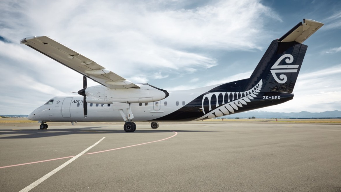
Air New Zealand has equipped one of its Dash 8s with a satellite receiver that will collect environmental data for NASA.
This content is available exclusively to Australian Aviation members.
A monthly membership is only $5.99 or save with our annual plans.
- Australian Aviation quarterly print & digital magazines
- Access to In Focus reports every month on our website
- Unlimited access to all Australian Aviation digital content
- Access to the Australian Aviation app
- Australian Aviation quarterly print & digital magazines
- Access to In Focus reports every month on our website
- Access to our Behind the Lens photo galleries and other exclusive content
- Daily news updates via our email bulletin
The first flight under the unique partnership departed on Tuesday, with ZK-NFA taking off from Christchurch at 11:49am as NZ8844 and landing in Nelson at 12:40pm local time.
The receiver, known as the Global Navigation Satellite System (GNSS) will use reflected GPS signals to collect climate data. This information will be used to advance climate change research and improve weather prediction capabilities.
NASA and Air New Zealand have been working together on the project since 2020.
The receivers will broadcast the climate and weather data to an operations centre established by the University of Auckland. Professor Delwyn Moller from the university said that the collaboration between NASA and the University would place New Zealand scientists on the cutting edge of the climate science field.
“The data produced by this collaboration will be made publicly available, opening up a range of research possibilities with many potential uses, from flood risk management to agriculture and resource planning,” said Moller.
The Q300 aircraft was chosen for the project due to the routes it operates and the altitude it flies at.

“With a network stretching from Kerikeri to Invercargill and flying at an altitude of around 16,000 feet, the Q300 was the perfect aircraft to pilot this mission,” said Air New Zealand Chief operational integrity and safety officer Captain David Morgan.
“Flying much closer to the land and sea than NASA’s satellites, our aircraft can collect a daily feed of high-resolution, high-quality data, with significant potential for the science community.”
Morgan also said that the airline would not shy away from its responsibilities to combat climate change, highlighting that it is a shared problem worldwide.
NASA Scientist Will McCarty spoke about the potential future uses of the system, saying that the data collected will be used to improve the range of NASA’s Cyclone Global Navigation Satellite System (CYGNSS) and allow it to monitor environmental changes over land.
“The receiver that Air New Zealand is flying has advanced capabilities with the potential to be used for future space-bound missions, so we’re excited to test these out,” he said.