

Warning: Undefined array key "image-size-770" in /data/www/upgrade/australianaviation.com.au/httpdocs/wp-content/themes/australianaviation/functions.php on line 1310
Warning: Trying to access array offset on null in /data/www/upgrade/australianaviation.com.au/httpdocs/wp-content/themes/australianaviation/functions.php on line 1310

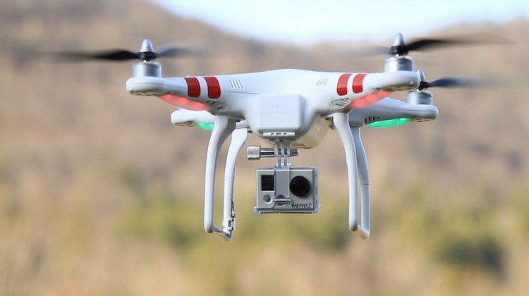
Operators of remotely piloted aircraft (RPA), or drones, asking the question “Can I fly there?” will now have the answer at their fingertips thanks to a new app from Australia’s Civil Aviation Safety Authority (CASA).
The app, developed by CASA in partnership with specialist drone software company Drone Compiler, will show no-fly zones and other “fly with caution” zones, as well as restricted and military airspace.
This content is available exclusively to Australian Aviation members.
A monthly membership is only $5.99 or save with our annual plans.
- Australian Aviation quarterly print & digital magazines
- Access to In Focus reports every month on our website
- Unlimited access to all Australian Aviation digital content
- Access to the Australian Aviation app
- Australian Aviation quarterly print & digital magazines
- Access to In Focus reports every month on our website
- Access to our Behind the Lens photo galleries and other exclusive content
- Daily news updates via our email bulletin
The “Can I fly there?” app will also include satellite photos of runway layouts and information about uncontrolled aerodromes and aircraft landing areas among other features, CASA said on Wednesday.
“Using a drone flyer’s location the app displays no-fly zones around major airports, the flight paths of smaller airports and helicopter landing areas,” CASA said in a statement.
“Information shown in the app is based on the standard operating conditions for very small commercial drones, known as the excluded category. This information should be used as a guide by recreational and certified drone flyers.”
The aviation safety regulator has published a video on the new app on its YouTube channel.
Minister for Infrastructure and Transport Darren Chester noted unmanned aircraft were increasingly being used for agriculture, mining, infrastructure assessment, search and rescue, fire and policing operations, aerial mapping and scientific research.
As a consequence, there was a lot of work being done on the safety and security matters relating to their use.

“The government is committed to fostering an environment that ensures the operation of drones are conducted safely, whilst also facilitating growth and innovation in the use of this exciting technology in Australia,” Chester said in a statement.
“Drones have the potential to improve productivity, reduce costs, and improve workplace safety, but must be operated safely.”
The app is available in Android and iOS, as well as a web-based HTML5 version.
New rules for the operation of these aircraft that were introduced in September 2016 meant people or organisations flying commercial RPAs weighing less than two kilograms did not have to apply to CASA for a certificate and licence.
CASA said the regulations “cut the cost and red tape” of operating these types of aircraft while ensuring the public remained safe.
Operators were also required to fly the aircraft under a number of specific conditions, including that they only be used during daylight hours and in line of sight, be more than 30 metres away from people and more than 5.5 kilometres away from a controlled airport. Their use over populous areas such as beaches, parks and sporting ovals, as well as near emergency operations such as bushfires, accidents or search and rescue areas, was also prohibited.


David
says:This is a very useful app! so much info and detail
Hayden.R
says:does it also work with other fixed wing RC aircraft?